Irrigation Endpoints
About
Here we list all the available endpoints from Leaf's Irrigation API. To call them easily, we recommend using Leaf's Postman collection.
All HTTP methods should be prepended by this service's endpoint:
This service has the following endpoints available:
| Description | Endpoints |
|---|---|
| Get all irrigation equipment | GET /users/{leafUserId}/irrigation-equipment |
| Get as-applied irrigation | GET /users/{leafUserId}/irrigation/applied-irrigation |
| Get all irrigated fields | GET /users/{leafUserId}/irrigation/fields |
| Get an irrigated field | GET /users/{leafUserId}/irrigation/fields/{fieldId} |
Get all irrigation equipment
GET /users/{leafUserId}/irrigation-equipment
Lists all irrigation system equipment available for a given leaf user.
Request examples
- cURL
- Python
- JavaScript
Response
Properties
These are the properties available:
| Property | Description |
|---|---|
id | The equipment ID |
providerEquipmentId | The equipment ID from the provider |
provider | The data provider: Lindsay or Valley |
name | The name of the equipment |
type | The irrigation system type |
pivotLength | The length of the equipment (meters or feet) |
endgunLength | The length of the endgun throw (meters or feet) |
pivotRuntime | The time a pivot takes to complete a full revolution (hours) |
brand | The brand of the equipment |
originalEquipmentData | Not normalized equipment information data such as original type and subtype as available in the provider |
* The unit of measure can be defined by the unitMeasurement configuration.
Get as-applied irrigation
GET /users/{leafUserId}/irrigation/applied-irrigation
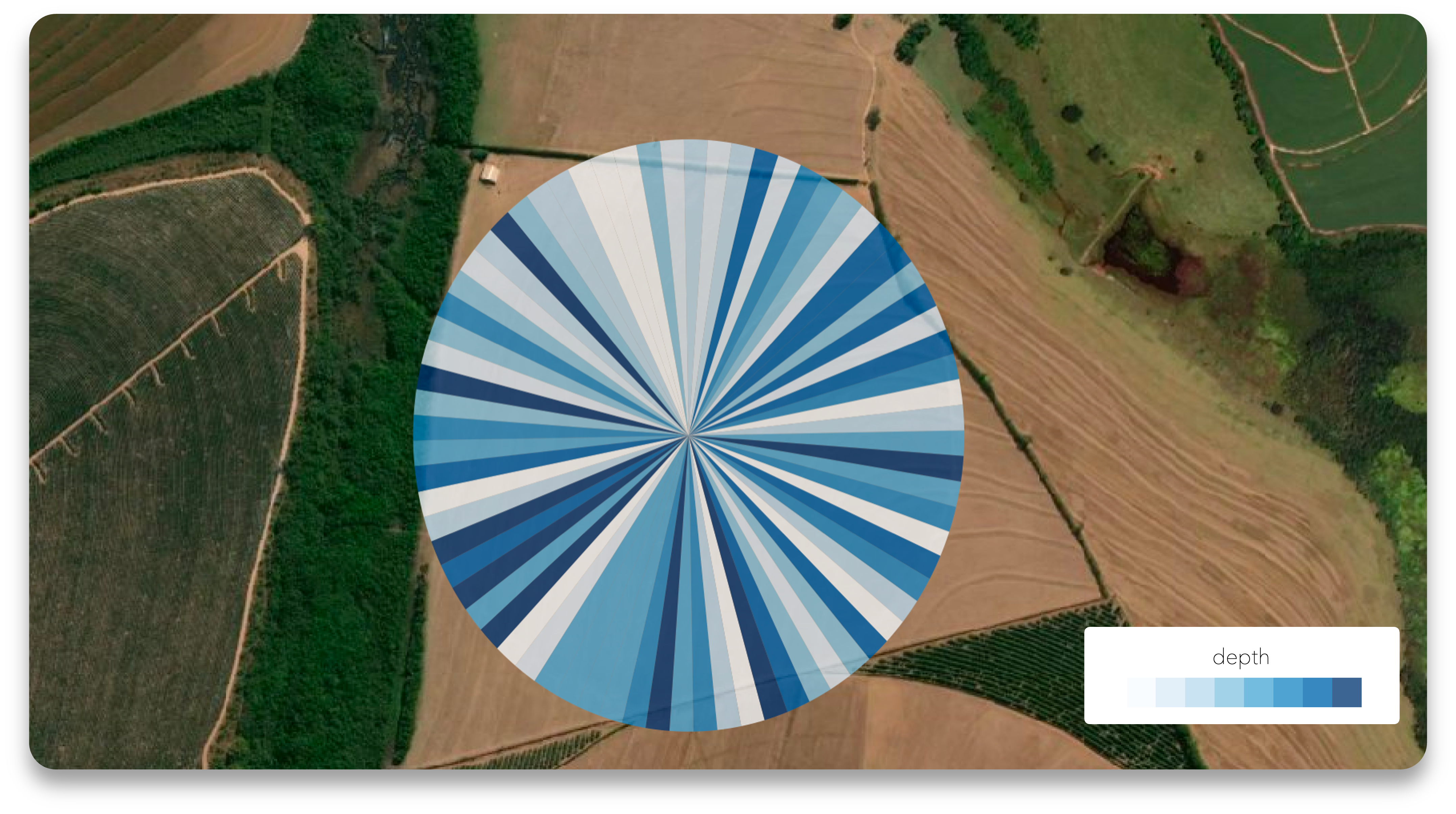
Lists all irrigation activities from supported providers, summarized by day and with information on the amount of water applied, stored in the depth property. The area covered by the irrigation and the different geometries for each depth value are also available in the irrigation standardGeojson.
Request examples
- cURL
- Python
- JavaScript
Response
Properties
These are the properties available:
| Property | Description |
|---|---|
id | The record identifier |
leafUserId | The Leaf User identifier |
apiOwnerUsername | The API Owner username |
startTime | The start of the irrigation period, typically the first hour of the day |
endTime | The end of the irrigation period, typically the last hour of the day |
provider | The irrigation data provider. It can be Lindsay or Valley |
equipment | The list of equipment that performed the irrigation, may contain the name, type and the identifier of the equipment at the provider (providerEquipmentId) |
createdTime | The time the record was created in Leaf |
Summary
Each record shows a summary of the day, with the following properties:
| Property | Unit of measure | Description |
|---|---|---|
| depth | mm or in | Basic statistics on the amount of water applied |
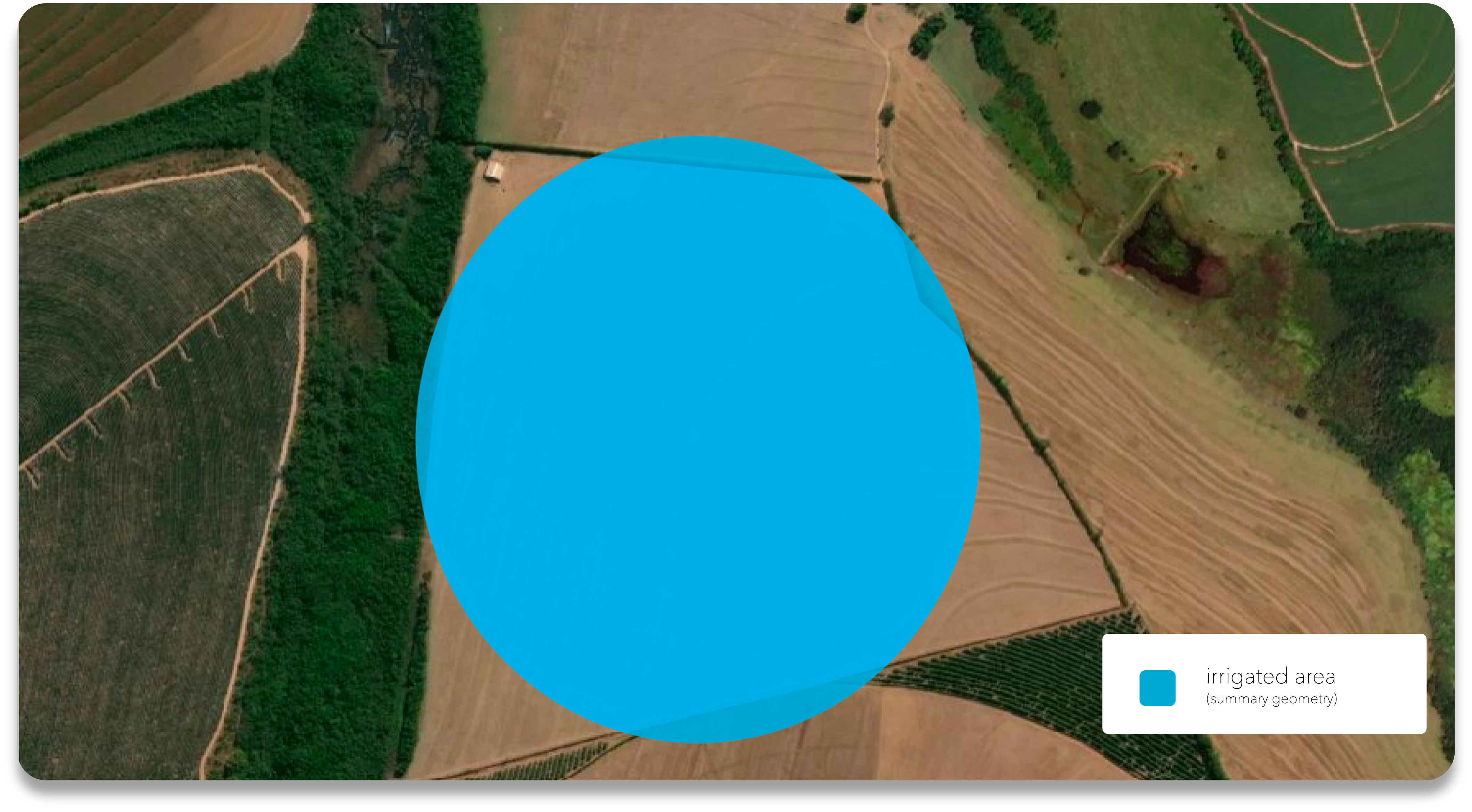
| totalArea | ha or ac | Total irrigated area |
| totalPowerOn | hr | Total time the pivot was ON for the given day |
| geometry | - | The geometry that represents the irrigated area |
* The unit of measure can be defined by the unitMeasurement configuration.
Irrigation StandardGeojson
The GeoJSON file for applied irrigation shows all irrigation values from an equipment for a given day. The file contains multipolygon geometries that represent the amount of water application for each area, in the depth property.
To view the field-related information, check the Get an irrigated field endpoint.
Get all irrigated fields
GET /users/{leafUserId}/irrigation/fields
Lists all fields that have received any irrigation at some point.
Request examples
- cURL
- Python
- JavaScript
Response
Get an irrigated field
GET /users/{leafUserId}/irrigation/fields/{fieldId}
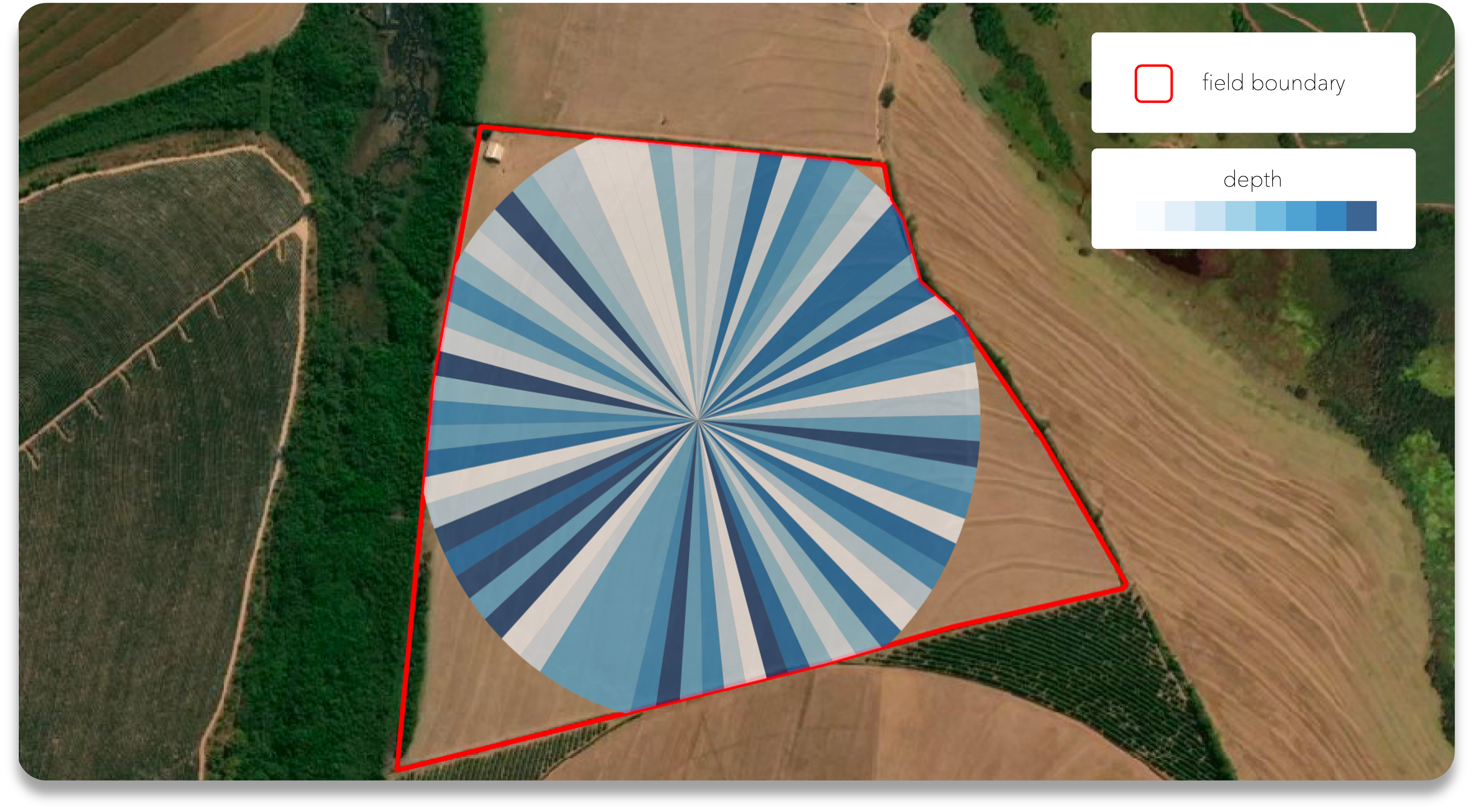
Gets information about irrigation performed in a specific field. It is valid for all existent field boundary from the Leaf user account.
Field boundary
This functionality associates field boundaries from any provider with irrigation data, so there must be existing field boundaries in the integrated leaf user to access it. Valley does not provide field boundaries and Lindsay requires the FieldNET Advisor product to make them available.
Request examples
- cURL
- Python
- JavaScript
Response
Properties
These are the properties available:
| Property | Description |
|---|---|
id | The record identifier |
leafUserId | The Leaf User identifier |
apiOwnerUsername | The API Owner username |
startTime | The start of the irrigation period, typically the first hour of the day |
endTime | The end of the irrigation period, typically the last hour of the day |
provider | The irrigation data provider. It can be Lindsay or Valley |
equipment | The list of equipment that performed irrigation, may contain the name, type and the identifier of the equipment at the provider (providerEquipmentId) |
createdTime | The time the record was created in Leaf |
Summary
Each record shows a summary of the day, with the following properties:
| Property | Unit | Description |
|---|---|---|
| depth | mm or in | Basic statistics on the amount of water applied |
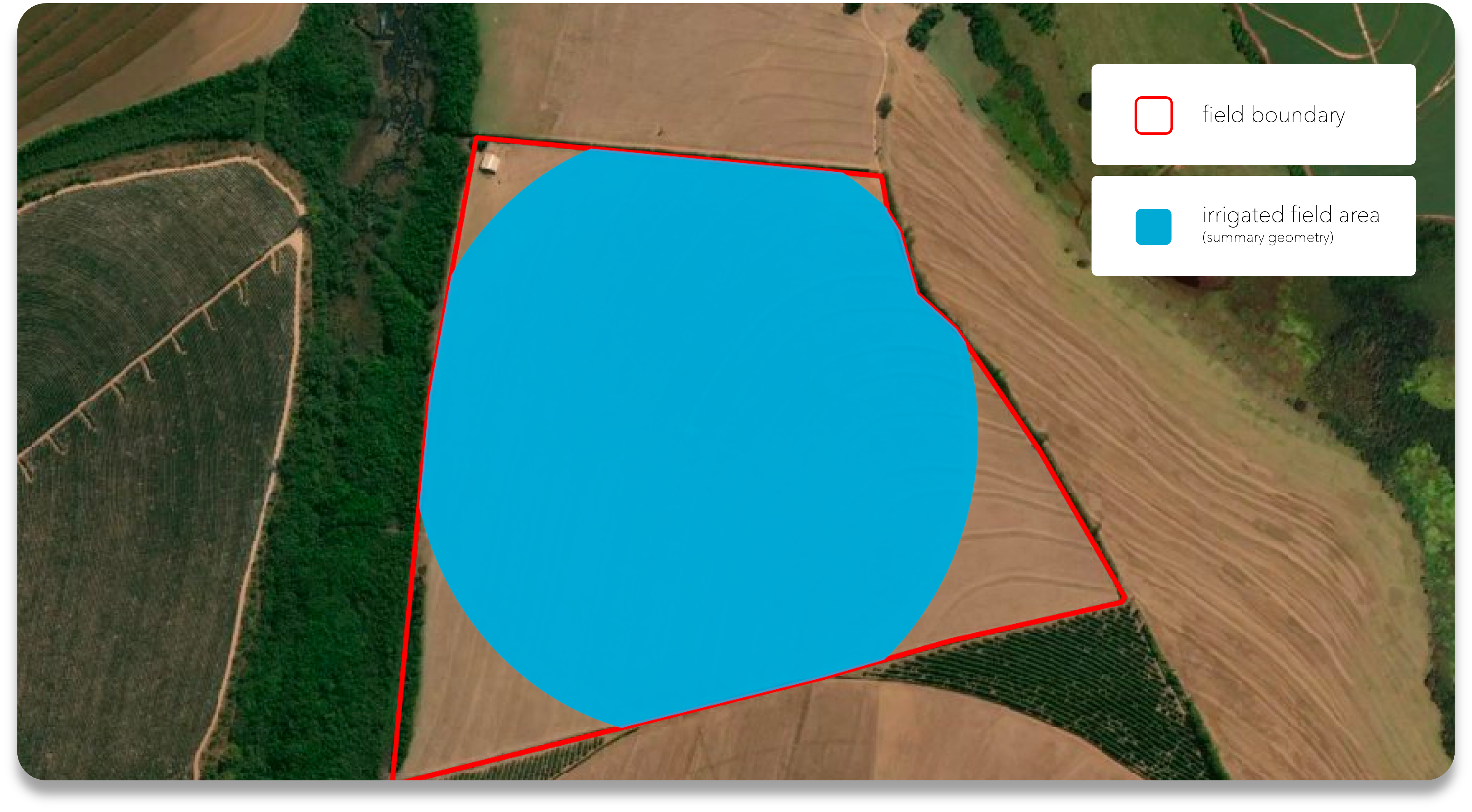
| totalArea | ha or ac | Total irrigated area for that given field |
| totalPowerOn | hr | Total time the pivot was ON for the given day |
| coverage | % | The percentage of field area covered by irrigation - the wetted area |
| geometry | - | The geometry that represents the field irrigated area |
* The unit of measure can be defined by the unitMeasurement configuration.
Irrigated field StandardGeojson
The GeoJSON file available for the irrigated field will show all irrigated areas within the field from an equipment for a given day. Each geometry is represented as multi polygons and is clipped by the field boundary geometry and represents the total volume of water applied to the location (the depth property).